18B.100.120 The Regulating Plan Map.
This section is included in your selections.
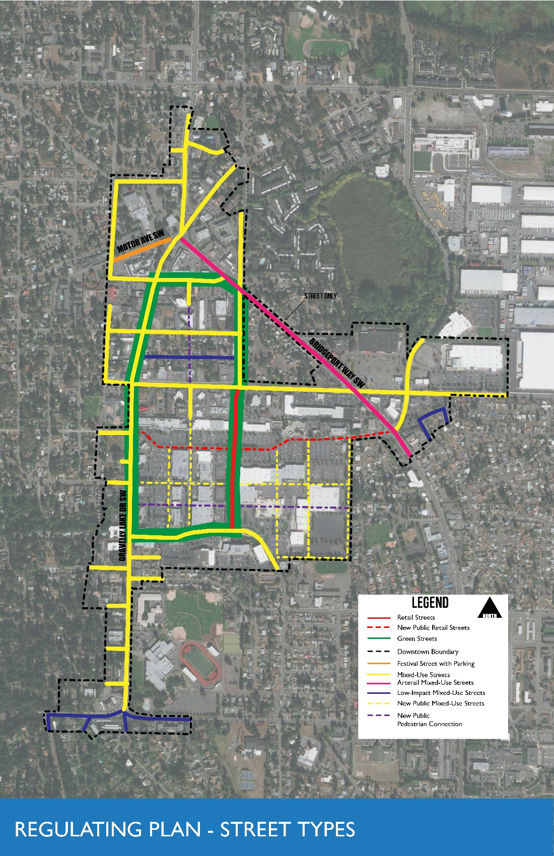
The regulating plan translates the community vision into a map. The regulating plan designates the locations, subdistricts, and streets that are intended to embody specific physical characteristics. It specifies the location and applicability of specific design treatments and maps where they are required. The regulating plan works in tandem with the development standards, tables, and figures to define the shape, size, and location of streets through connections, infill blocks, buildings, and landscaping.
18B.120-1. Regulating Plan
[Ord. 695 § 2 (Exh. B), 2018.]